

Trimble Field Technology
Imagine starting a refit and renovation project with precise and accurate details of the as-built conditions already in hand? With Trimble’s 3D laser scanners, having no original drawings is not a problem. Knowing exactly what to expect before work starts, reduces design errors and costly field rework. You can also reap the rewards of having accurate as-built conditions for new construction projects and QA/QC it. This information is invaluable to owners and allows for reducing costs on future work. Scan the physical environment and capture accurate measurements for use in your design and detailing process.
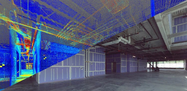
The registered point cloud data is invaluable in overcoming the usual challenges posed by refit and renovation projects. The built-in camera means the point cloud will be in full, photo-realistic, color. Trimble’s 3D Laser Scanners are the ultimate answer for contractors looking to tackle complex retrofit projects while meeting tight deadlines and maintaining profitability.
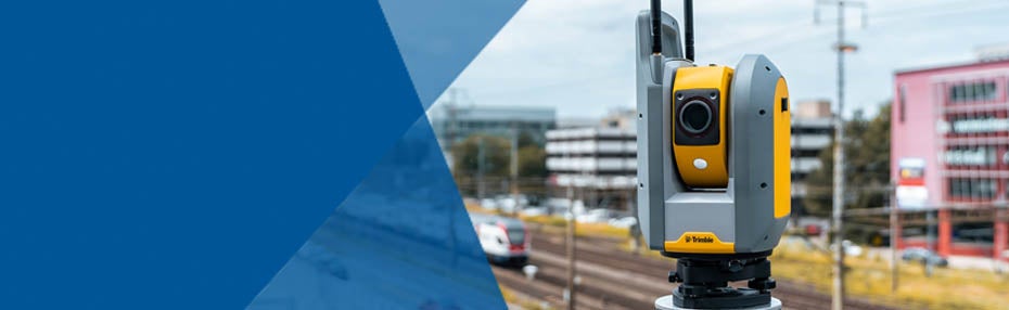
Trimble Scanners
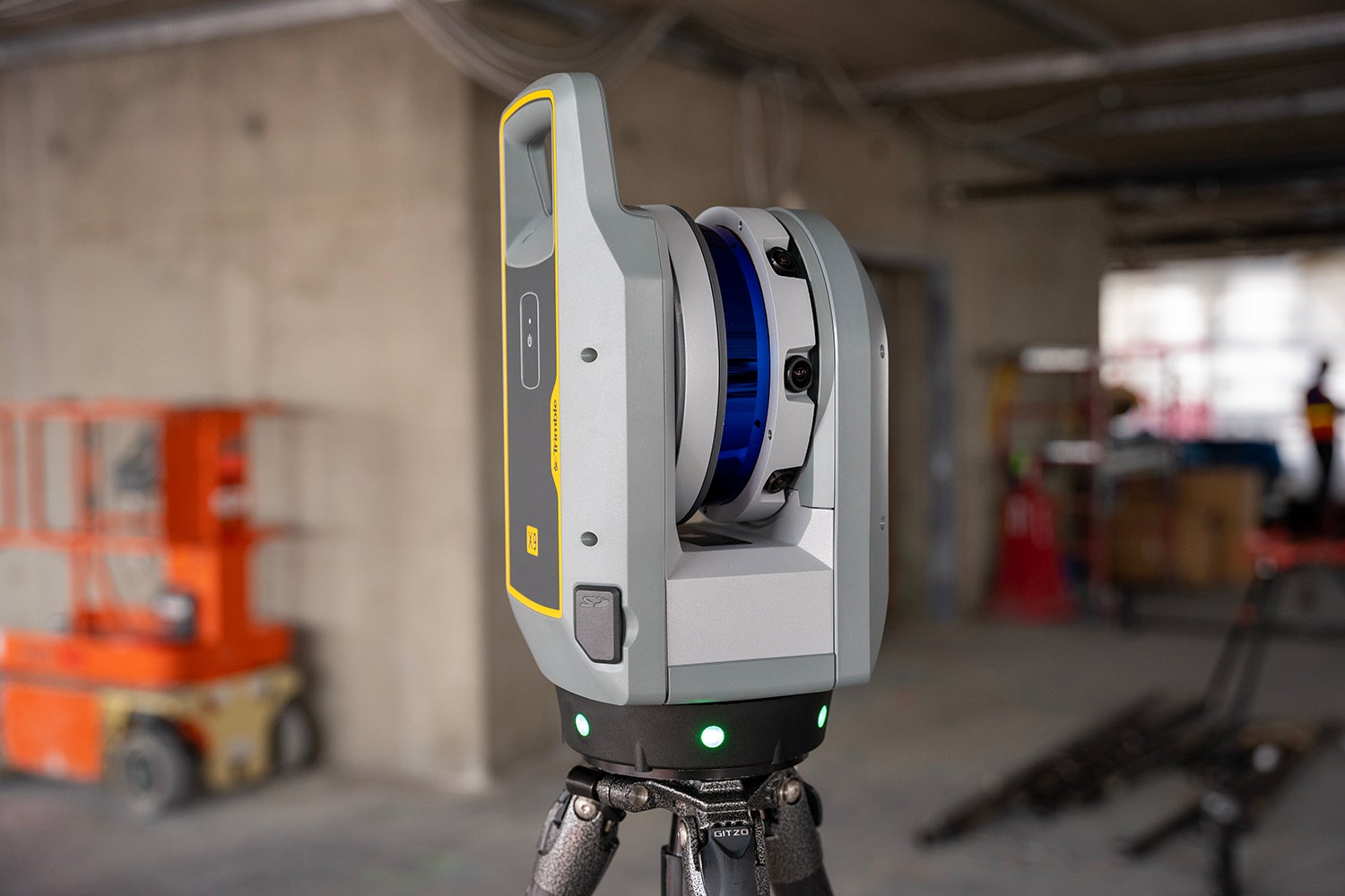
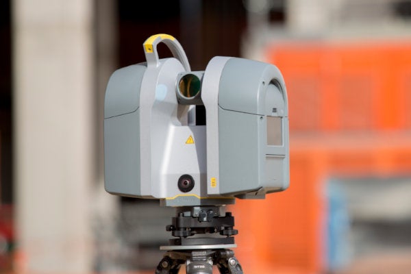
Trimble X9
An innovative, high-speed 3D laser scanning system with enhanced performance and function to increase efficiency and provide confidence in the field.

Trimble X7
The X7 is the first 3D scanner to provide an auto-calibration routine to ensure data accuracy, eliminate downtime from annual calibration service, and provide a lower overall cost of ownership.
Trimble TX6 and TX8
The Trimble TX Series of 3D laser scanners for building construction applications offers you a choice in how you can approach data capture on any jobsite to keep up with the demands of today’s need for better, more detailed information that can be used in design or progress analysis of your project.
Software and Services
Trimble RealWorks
Trimble 3D scanning software allows you to integrate 3D point and survey data to extract measurements, generate deliverables and utilize inside 3D CAD software.
CloudEngine
Trimble CloudEngine is a powerful, next-generation point cloud application that provides easy-to use editing, manipulation, and analysis tools.
Scanning and Modeling
Laser Scanning continues to change the way that owners, architects, and contractors view their projects.
Digital Twinning
The as-built 3D Model is used to visualize security scenarios, and plan/inspect Fire Life Safety requirements.
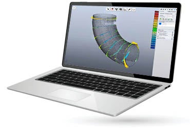
SketchUp Pro Scan
SketchUp Pro Scan empowers you to turn point clouds into clear 3D and 2D visualizations that everyone can understand.
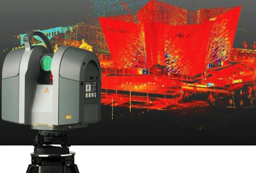
What is Reality Capture?
Reality capture involves a rotating laser that defines all object in its field of vision with millimeter accuracy.
Using an infrared light to determine the distance between itself and an object, the scanner monitors how long it takes the lasers’ pulse to bounce back. Based on the differences in laser return times, and by varying laser wavelengths, the 3D scanner produces a digital 3D image that looks very similar to a photo, but data rich. This resulting 3D representation is called a point cloud. LIDAR 3D scanners are commonly used to collect as-built conditions in construction, facilities, and manufacturing to name a few.
Benefits of Reality Capture:
- Produce a true to scale digital representation of a built space
- Bring the field to the office, allowing you to identify and solve existing condition issues before ever breaking ground on a project
- Quickly compare existing conditions against design drawings or a 3D model in-situ
- Non-contact measurement tools, reducing the need to put contractors in high-risk areas/situations
- The first step in any pre-construction simulation
Uses:
- Capture as-built conditions, model existing spaces for prefabrication and QA/QC installs
- Capture images and point clouds in relation to survey control for documentation and/or digital twinning
- Determine FF/FL based on the ASTM Standard
- Calculate volumes of dirt or shotcrete and concrete
- Accurately verify location and rotation of anchor bolts
